

Brigetio, at Szőny-Vásártér
polgárváros
Excavation Directors
Dr. László Borhy
Dr. Dávid Bartus
Excavation Period
1992-2016
Period
Roman Era
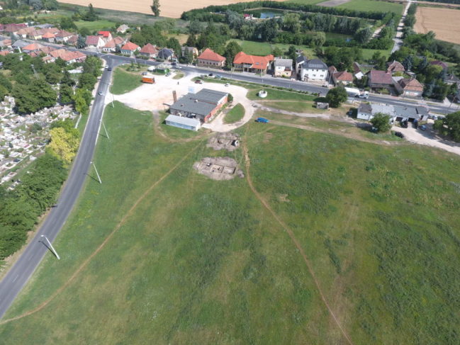
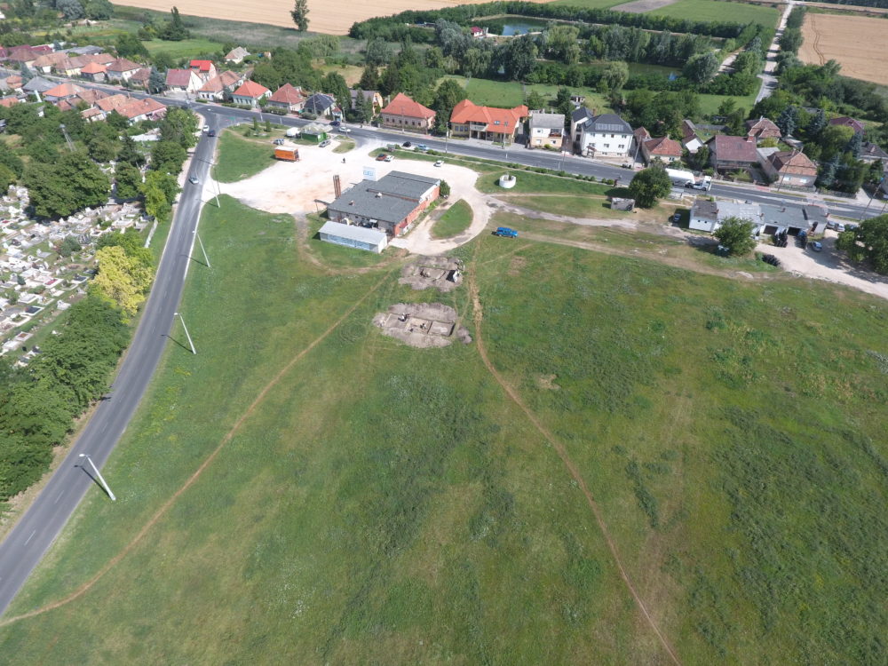
Among the various parts of Brigetio, the civilian town located about 2 km west of the military camp is the least known in terms of its exact location, topography, and internal structure. The Szőny Market Place, traditionally considered the "forum of the Roman town," has appeared to be the most suitable area for researching the history of the Roman city. This relatively large, continuous area offers an opportunity to gain archaeological data on the structure of Brigetio through systematic excavation.
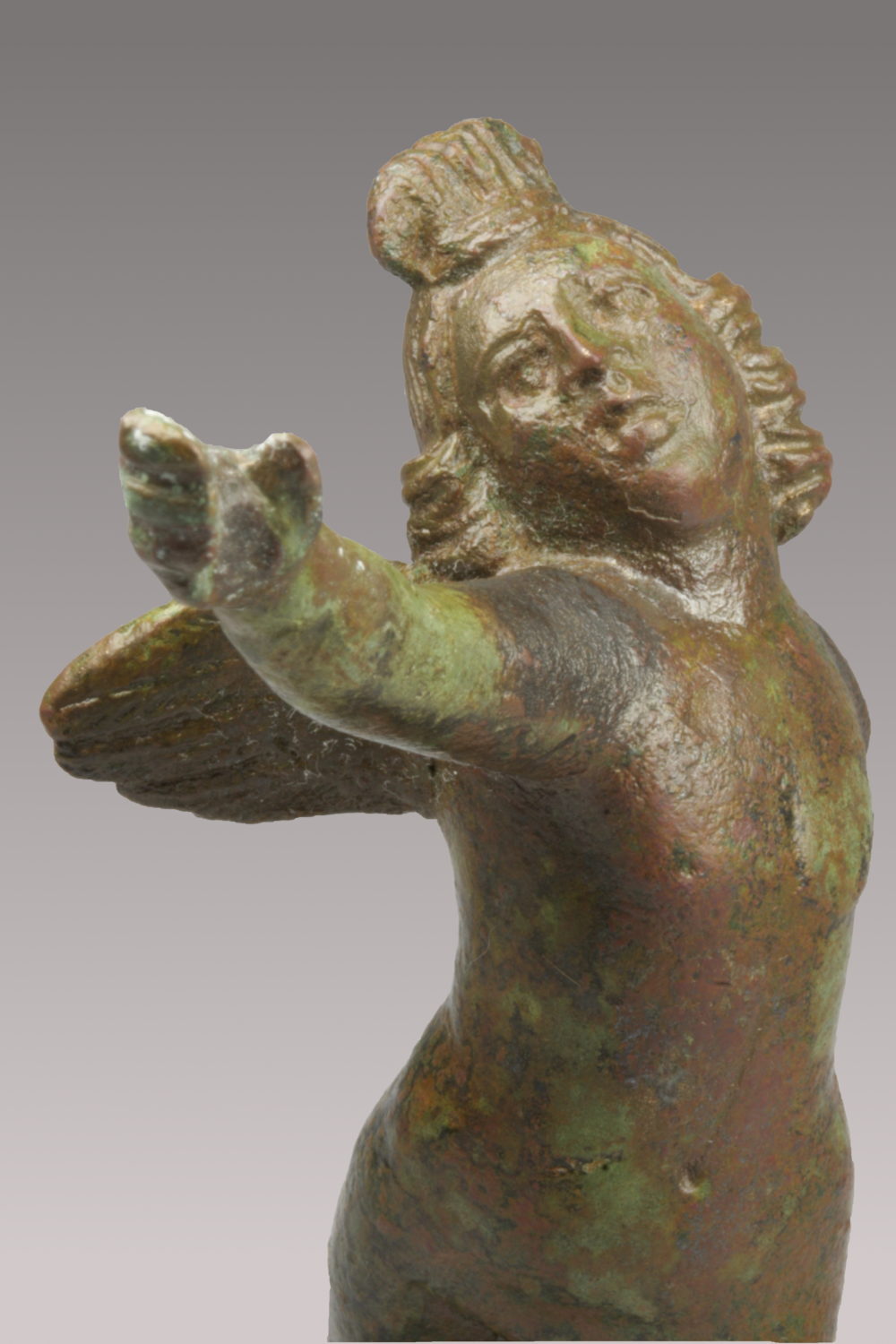
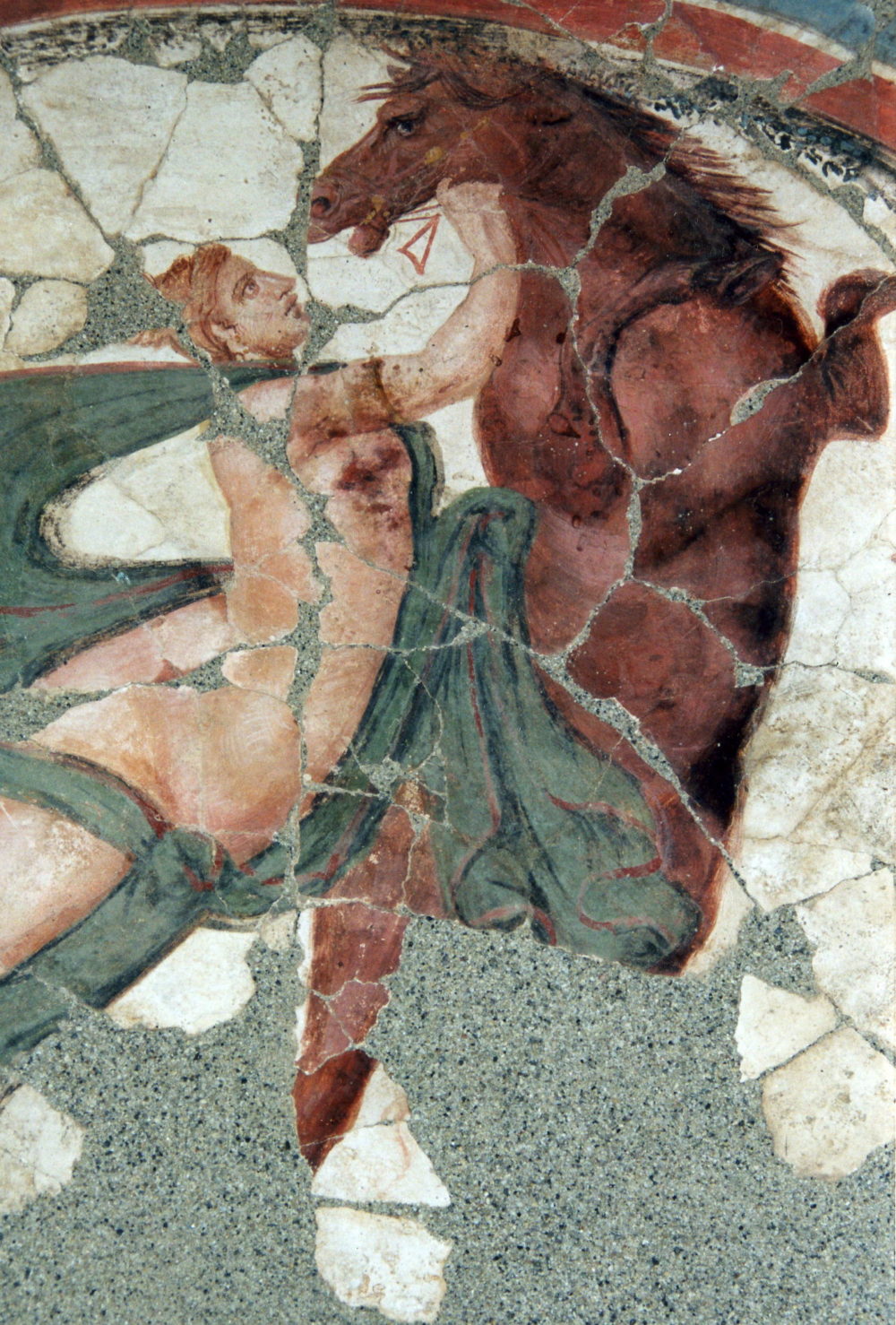
During the reign of Caracalla, when Brigetio was administratively transferred to the province of Lower Pannonia (Pannonia inferior) in 214 AD, the civilian settlement received municipal status (municipium) and shortly thereafter was elevated to the rank of a colonia. However, the exact extent of the settlement can only be inferred from the presumed course of the former city walls and the cemeteries located between the canabae (civilian settlements near military camps) and the urban center. Two main factors limit our understanding of the internal layout: firstly, modern Szőny is largely built on the site of the Roman city, and many ancient stone walls discovered during residential construction have been dismantled and their materials reused; secondly, until recent years, only rescue excavations have been conducted in this area. Nevertheless, the building remains uncovered during rescue excavations in Szőny mostly represent large residential houses richly decorated with wall paintings and equipped with underfloor heating systems.
Since 1992, the Department of Ancient Archaeology has been conducting planned excavations in the civilian part of ancient Brigetio. The digs at the Szőny Market Place—likely located near the center of the former municipium—have uncovered several large, north–south oriented houses with stone foundations, sophisticated wall paintings, and hypocaust heating systems. These houses, some of whose entrances have been located, were bordered and divided into residential blocks (insulae) by streets paved with stone slabs.
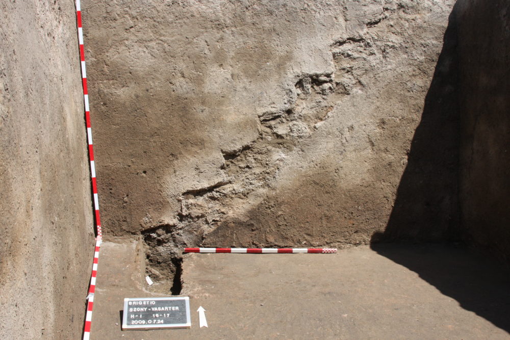
The earliest phase of these buildings, dating to the early 2nd century AD, consisted of stone-founded mudbrick walls. This phase was partially demolished and expanded during the later Antonine period. The buildings were likely destroyed at the end of the first third of the 3rd century during the reigns of Severus Alexander (222–235) and Gordian III (238–244), probably due to barbarian invasions. Following this destruction, the neighborhood was abandoned until the late 3rd century. Signs of reoccupation appear during the reigns of Aurelian and especially Probus, when significant urban restructuring took place.
This short-lived phase is characterized by makeshift, temporary structures built on top of the rubble of former buildings, often reusing roof and stone debris; post-built constructions embedded into former terrazzo floors; and crude drainage systems fashioned from roof tiles and stones running through the building remains. Despite 25 years of excavations at the Market Place, with only a few stray finds, no artifacts dating to the 4th century or later have been discovered, suggesting that the city’s inhabitants likely retreated in late antiquity either to the more secure military camp nearby or directly within its boundaries.
Gallery
Gallery


0
/
0


0
/
0